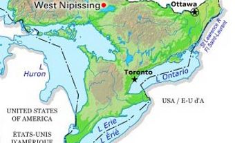
Dunnville, Ont, urban area, population 5789 (2011c), 5729 (2006c). Dunnville was established in 1974 as a town in the Regional Municipality of Haldimand-Norfolk from the former townships of Canborough, Dunn, Moulton and Sherbrooke and the town of Dunnville. A number of small communities existed within the town's boundaries including Attercliffe Station, Canborough, Moulton Station, Byng, Lowbanks, Stromness and Port Maitland. In 2001, the regional municipality was abolished, and the local municipalities of Dunnville, Haldimand and part of Nanticoke were amalgamated into the single-tier authority of the town of Haldimand (now the city of Haldimand County).
Located on the Lower Grand River near where it meets Lake Erie, the original Dunnville was initiated in 1829 when a dam was built across the Grand River to supply water for the Welland Canal. As this dam served also as a bridge, the first upstream from Lake Erie, Dunnville (with Byng on the opposite bank) grew as a focal point in the evolving road network. A milling district developed between the feeder canal and the river, and Dunnville expanded as a port on both the Grand River and the Welland Canal. Incorporated as a village in 1860 and as a town in 1900, Dunnville attracted textile industries but remains a service centre for a rural mixed farming and lakeside summer cottage area. During World War II, No 6 Service Flying Training School operated in nearby Dunn Township and involved, in one way or another, half of the town's population.

 Share on Facebook
 Share on X
 Share by Email
 Share on Google Classroom


