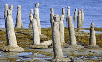
Cape St Mary's, elevation 105 m, on Newfoundland's AVALON PENINSULA, is the steep and spectacular terminus of the land separating ST MARY'S BAY and PLACENTIA BAY near rich fishing grounds. The site of a lighthouse since 1860, the cape and adjacent Rock Island have been protected provincially since 1964. Established in 1983 as an ecological reserve (area, 64 km2, of which 54 km2 is water), Cape St Marys is home to large populations of seabirds, including one of North America's 6 northern GANNET colonies. The accessibility of Cape St Marys allows easy viewing of the large congregations of nesting seabirds, providing an outstanding opportunity to observe their habits.
-
- MLA 8TH EDITION
- Pitt, Robert D.. "Cape St Mary's". The Canadian Encyclopedia, 04 March 2015, Historica Canada. www.thecanadianencyclopedia.ca/en/article/cape-st-marys. Accessed 23 December 2024.
- Copy
-
- APA 6TH EDITION
- Pitt, R. (2015). Cape St Mary's. In The Canadian Encyclopedia. Retrieved from https://www.thecanadianencyclopedia.ca/en/article/cape-st-marys
- Copy
-
- CHICAGO 17TH EDITION
- Pitt, Robert D.. "Cape St Mary's." The Canadian Encyclopedia. Historica Canada. Article published February 07, 2006; Last Edited March 04, 2015.
- Copy
-
- TURABIAN 8TH EDITION
- The Canadian Encyclopedia, s.v. "Cape St Mary's," by Robert D. Pitt, Accessed December 23, 2024, https://www.thecanadianencyclopedia.ca/en/article/cape-st-marys
- Copy
Thank you for your submission
Our team will be reviewing your submission
and get back to you with any further questions.
Thanks for contributing to The Canadian Encyclopedia.
CloseArticle
Cape St Mary's
Article by Robert D. Pitt
Published Online February 7, 2006
Last Edited March 4, 2015
Cape St Mary's, elevation 105 m, on Newfoundland's AVALON PENINSULA, is the steep and spectacular terminus of the land separating ST MARY'S BAY and PLACENTIA BAY near rich fishing grounds. The site of a lighthouse since 1860, the