Share on Facebook
 Share on X
 Share by Email
 Share on Google Classroom
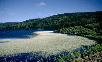
Located some 45 km east of Flin Flon, Grass River Provincial Park (established 1963, 2289.63 km2) straddles 2 of Manitoba's natural regions (Boreal Plains and Boreal Shield).
Natural History
The park is a chain of lakes (Simonhouse to Tramping Lakes) strung along and draining into the Grass River. Along Highway 39, running through the southern part of the park, the landscape is dominated by dolomite rock. The majority of the park, which lies north of the highway, is underlain by dark rocks of the Canadian Shield. Karst Spring pouring out from a rock cliff joins the 2 natural regions at Iskwasum Lake. The park is home to woodland caribou, moose, waterfowl and sport fish.
Human History
Cree migrated from the Great Plains to the area about 200 generations ago. The Grass River waterway provided them with their livelihood and transportation. The first European known to have travelled the river was Joseph Smith of the Hudson's Bay Co in 1763. Twenty years later, David Thompson and Samuel Hearne used the river in search of furs. Today canoeists and anglers travel the scenic waterway and enjoy some of the best road accessible fishing in Manitoba.
Facilities
The park has 3 campgrounds (Gyles, Iskwasum Landing and Reed Lake) each with picnic shelters, a boat ramp, playground and beach.